
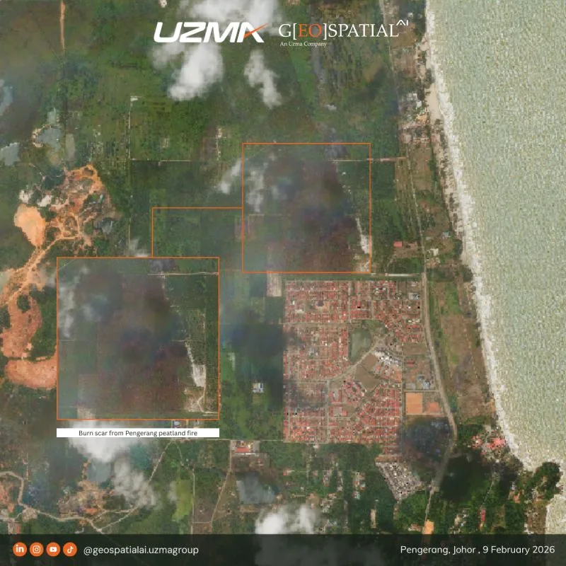
In late January 2026, a major peatland fire broke out in the Punggai area of Pengerang, spreading rapidly along Jalan Sungai Kapal near Taman Bayu Damai.
Satellite imagery captured on 9 February 2026 reveals the aftermath — significant landscape alteration and measurable environmental impact. More than half of the estimated 100 hectares affected has since been brought under control.
Peatland fires are especially complex. Unlike surface fires, they smoulder beneath the ground, making detection and containment far more challenging.
This is where satellite-based monitoring becomes critical.
Through Earth Observation analysis, we are able to:
· Map burn extent with precision
- Quantify vegetation loss
- Support rapid damage and recovery assessment
- Track progression over time
At Geospatial AI, we convert satellite data into operational intelligence — supporting disaster response, environmental protection, and long-term resilience planning.
For collaboration or further information: geospatial.ai@uzmagroup.com
Originally shared on Geospatial AI on LinkedIn.