

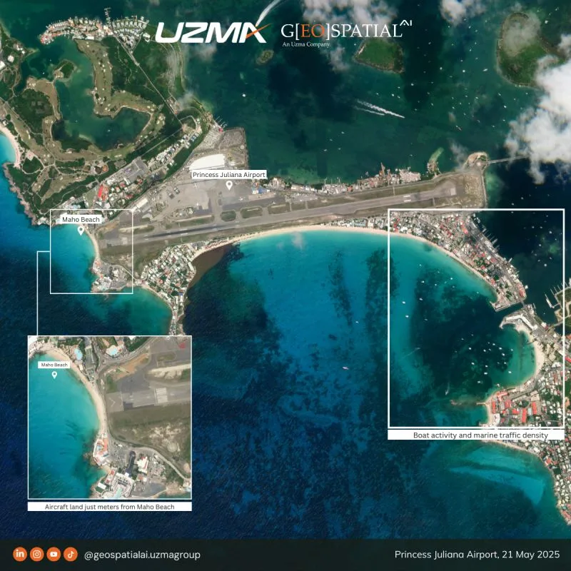
We bring you to the Princess Juliana International Airport (SXM) in Sint Maarten. An airport where it is world-famous for its low-altitude landing approaching few meters above Maho Beach, which sits directly at the end of the 2300 meters runway between the Caribbean Sea and dense urban development.
From space, this satellite imagery reveals how the airport operates within these natural and urban boundaries. Earth observation helps monitor runway proximity to the coastline, aircraft approach paths, and near-shore marine traffic patterns, supporting aviation safety, coastal assessment, and maritime awareness.
A unique blend of geography, engineering, and space-based insight — proving that seeing from above helps us see better and see the bigger picture.
For further info, contact us at geospatial.ai@uzmagroup.com.
Originally shared on Geospatial AI on LinkedIn.