
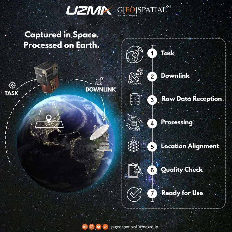
Captured in Space. Processed on Earth.
A satellite image is not instantly ready the moment it is captured.
Before it becomes useful, satellite data needs to go through several important steps — from tasking to final delivery.
Tasking
The area of interest is assigned to the satellite based on the required location, timing, and imaging needs.
Downlink
Once captured, the data is transmitted from the satellite to a receiving station on Earth.
Raw Data Reception
The station receives the data, but at this stage it is still in raw form and not yet ready for direct use.
Processing
The data is cleaned, corrected, and converted into usable satellite imagery.
Location Alignment
The image is aligned to its correct position on Earth so it matches real-world maps, boundaries, and locations accurately.
Quality Check
The image is reviewed for issues such as cloud cover, haze, blur, or other quality concerns.
Ready for Use
Only after these steps can the image be used for mapping, monitoring, planning, and decision-making.
This is why satellite technology is not just about what happens in space.
The real value happens on Earth — turning raw satellite data into information people can actually use.
Originally shared on Geospatial AI on LinkedIn.